Problem
This exercise was part of ESRI’s Using Raster Data for Site Selection tutorial and is called “Use fuzzy logic to model bald eagle habitat”. The goal is to model boundaries associated with bald eagle habitat at the Big Bear Lake in the San Bernadino National Forest. Naturally there is uncertainty associated with any such analysis as these are living creatures and not easily quantifiable. Fuzzy logic is used to model the scenario and quantify the degree of uncertainty.
Analysis procedures
Strategies: ArcMap fuzzy logic tools are used to create fuzzy layers for the variables of interest and then overlay them for a final result. The variables considered are distance from human activity/infrastructure, proximity to water, and optimal forest cover. A fuzzy layer is created for each and the three layers are overlaid, a logical AND operation, with the Fuzzy Overlay tool for a final result.
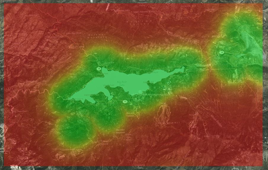
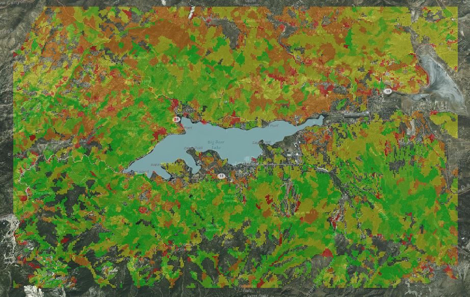
Methods: A fuzzy water distance layer is created using the Fuzzy Membership tool with a raster layer input that represents distance to water. A small membership type is used so that small values (close to water) have high membership. The Fuzzy Membership tool is then used to create a fuzzy human disturbance layer on an input distance to human disturbance raster. The membership type chosen is linear in this case, which results in a maximum membership value of 1 and a minimum of 0 with actual assigned values increasing linearly with distance from human disturbance. A fuzzy land cover layer is created using the Fuzzy Membership tool on a reclassified land cover raster layer with a Near membership type specified. This membership type assigns a value of 1 (full membership) at the midpoint value and decreasing membership values as distance from this midpoint increases. This membership type reflects bald eagle behavior at the site, who prefer to nest in areas of medium forestation- between 40 and 70% forest covered.
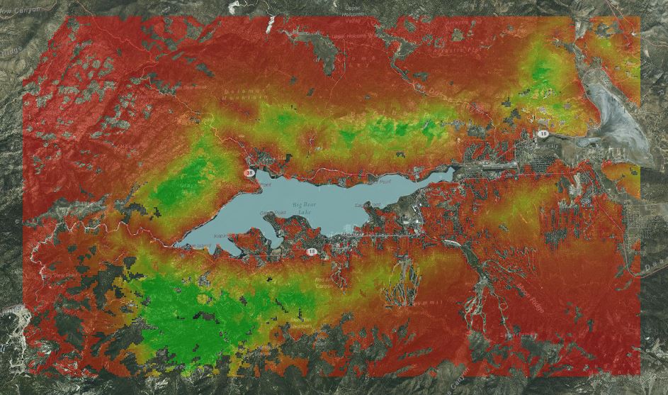
The generated layers are overlaid with the Fuzzy Overlay tool, a logical AND operation which reflects in the final result a membership value that reflects all three variables. Green areas indicate full membership relative to the three criteria, red shows non-membership and yellow is fuzzy, indicating a partial membership.
Results
Fuzzy layer for distance to water:
Fuzzy layer for tree cover:
The Final Overlay Result, Green indicates full membership:
Application and Reflection
Problem Description: Use fuzzy logic to model hurricane storm strength relative to possible locations.
Data Needed: Raster layers associated with variables that influence the growth/decay of a storm relative to potential paths. Examples include surrounding pressure gradients and movements, water and air temperatures, water depth, and high atmosphere conditions.
Analysis Procedures: Assign fuzzy membership values for each layer that is relevant for the layer described. For example, higher water temperatures are probably favorable for storm growth so a linear membership type could be assigned from the current storm location. Overlay the layer results to generate a fuzzy model that indicates a model of storm intensities that is dependent on the path it takes.