Turning Data into Information Using ArcGIS 10.0 module 6: Uncertainty
Problem: Transform digitized xy coordinate system measurements to a real-world coordinate system. This exercise transforms street centerline data from an aerial image using ground control points and then does error checking by examining the Root Mean Squared Error (RMSE).
Analysis Procedures: A subdivision data frame represents a new subdivision and the surrounding streets, however no street centerlines. This frame is in real-world feet units. A digitized streets frame contains an addition layer with digitized lines from an aerial photograph representing streets. A snapping environment is established so that added links are set appropriately at the control points. The control points are known locations of features and are generated using a GPS. Displacement links are created from each control point and the centerline data is transformed using Adjust on the Spatial Adjustment menu. A projection is defined to generate the new street centerlines within the subdivision.
Results:
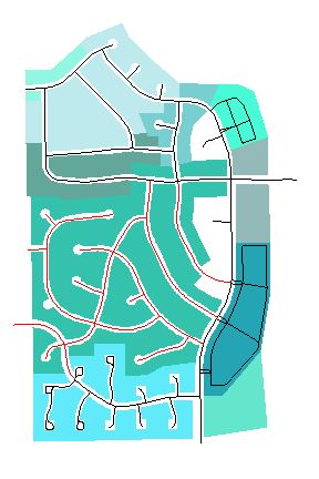
Final Result showing new centerlines:
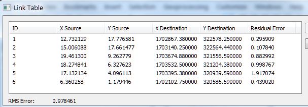
RMSE (feet) after best fit between souce/destination control points:
Application & Reflection
Problem description: Transform sewer lines based on proximity to waterway.
Data needed: Control points based on known location of waterway.
Analysis procedures: Map and transform sewer line path using known waterway geographic coordinates as control points.